Dams & Maps
Our Dams — Infrastructure, Location, and Maps
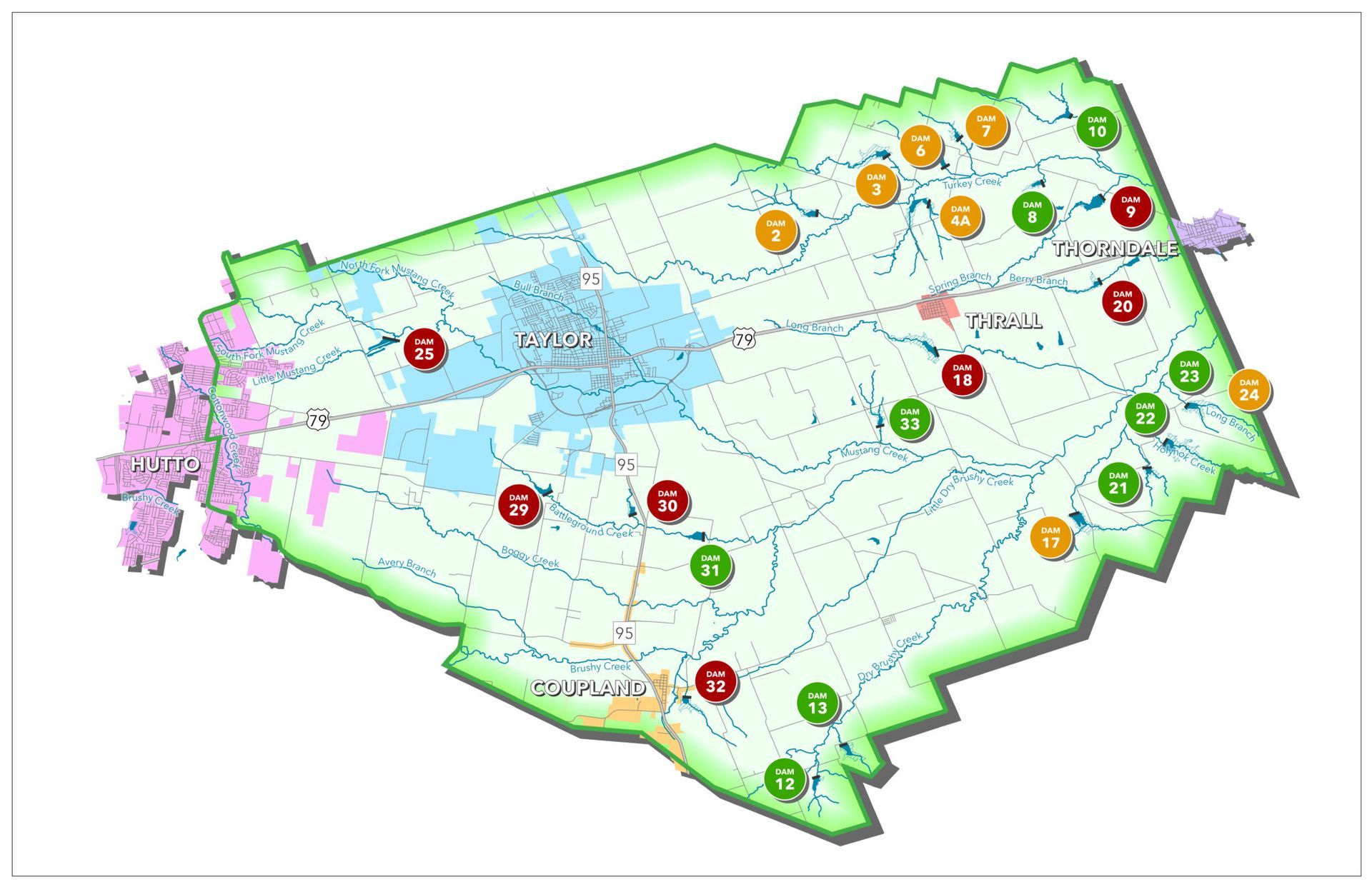
The Lower Brushy Creek Water Control & Improvement District operates and maintains 23 earthen flood control dams across eastern Williamson and western Milam Counties in Central Texas. These structures were designed to manage floodwater, reduce flood risk, and protect lives and property.
District Dam Overview
The Lower Brushy Creek WCID’s dam network consists of 23 earthen flood control structures built with technical and financial assistance from the USDA Natural Resources Conservation Service, formerly 'Soil Conservation Service’. These dams are essential components of local stormwater management.
Each dam has a unique site number and associated data like hazard classification, elevations, and any ongoing or planned improvements. As part of ongoing operations, the district routinely updates this information and shares maps and site details to support public awareness and safety planning.
Individual Dam Summaries
Click on site below to open up the full page.
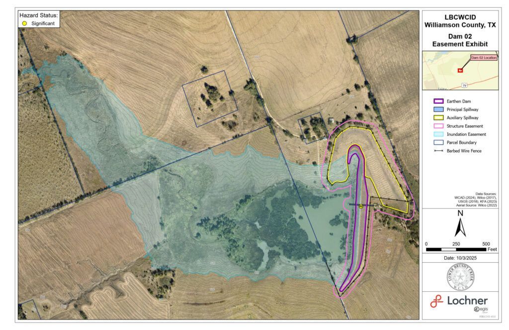
Site #2
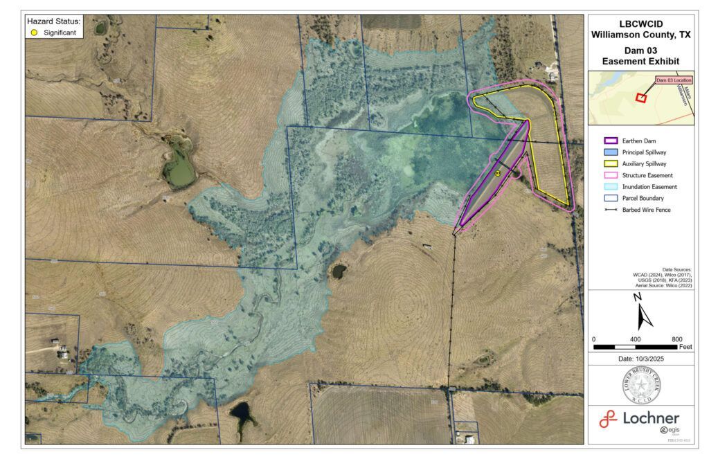
Site #3
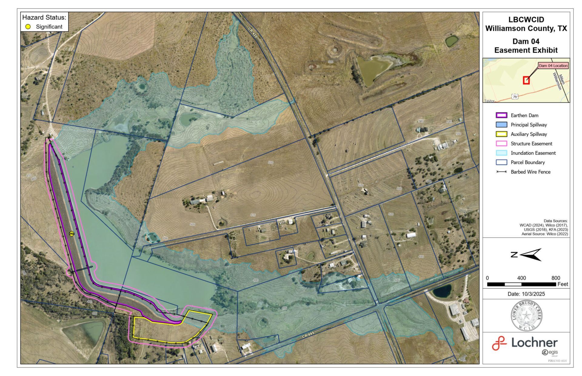
Site #4

Site #6
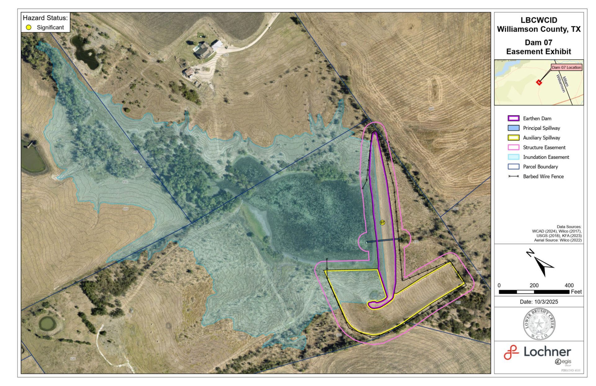
Site #7
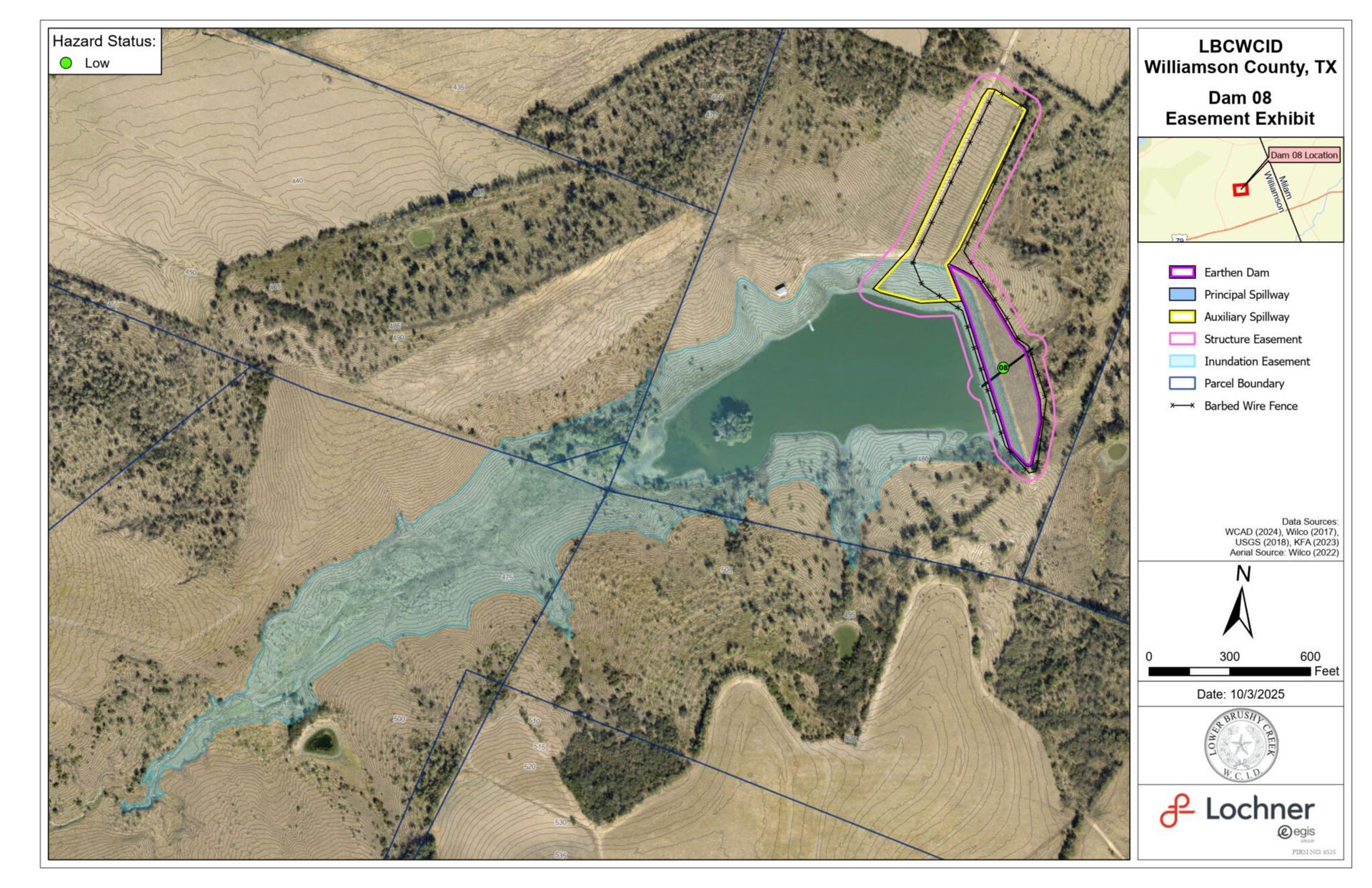
Site #8
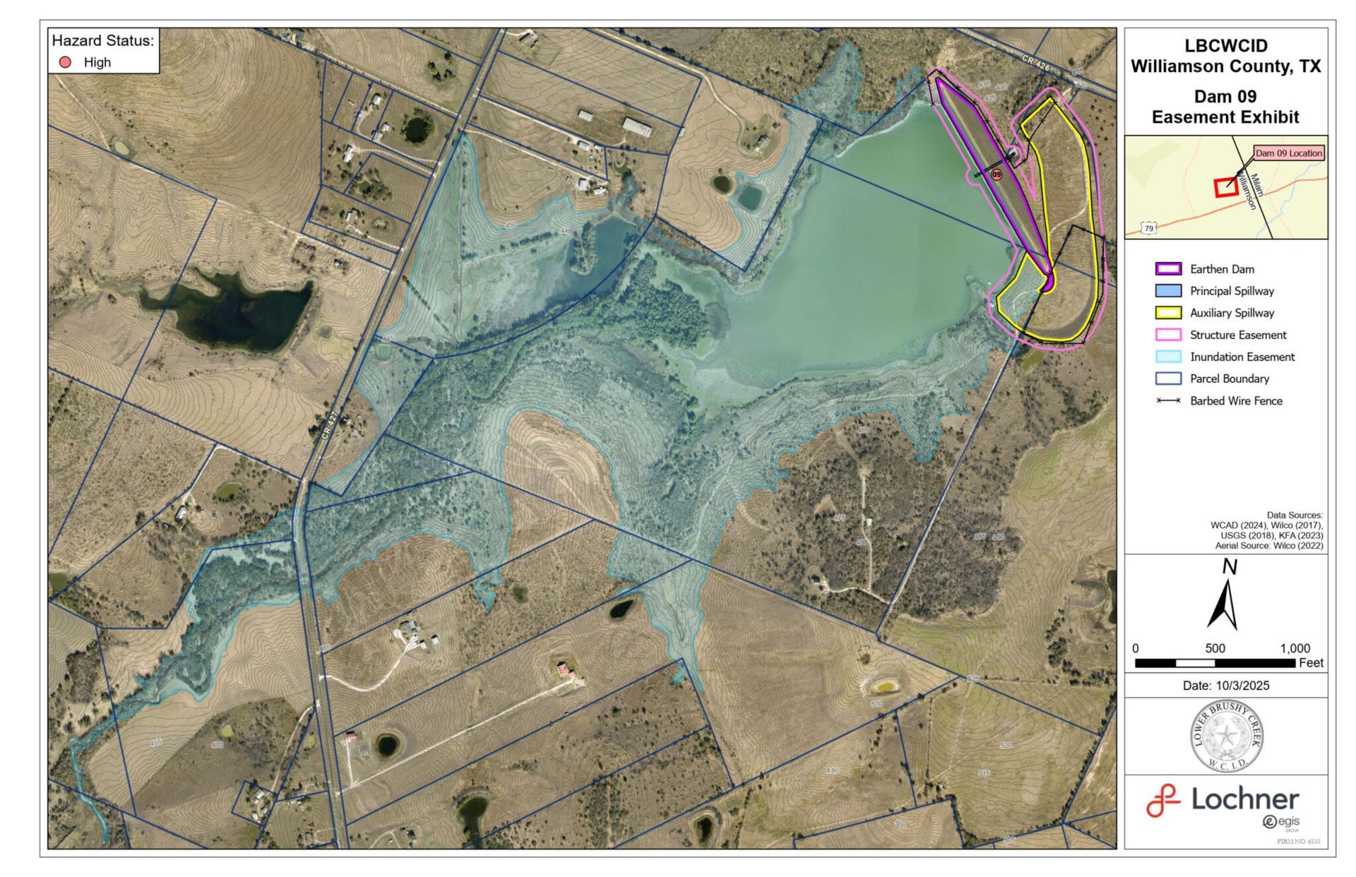
Site #9
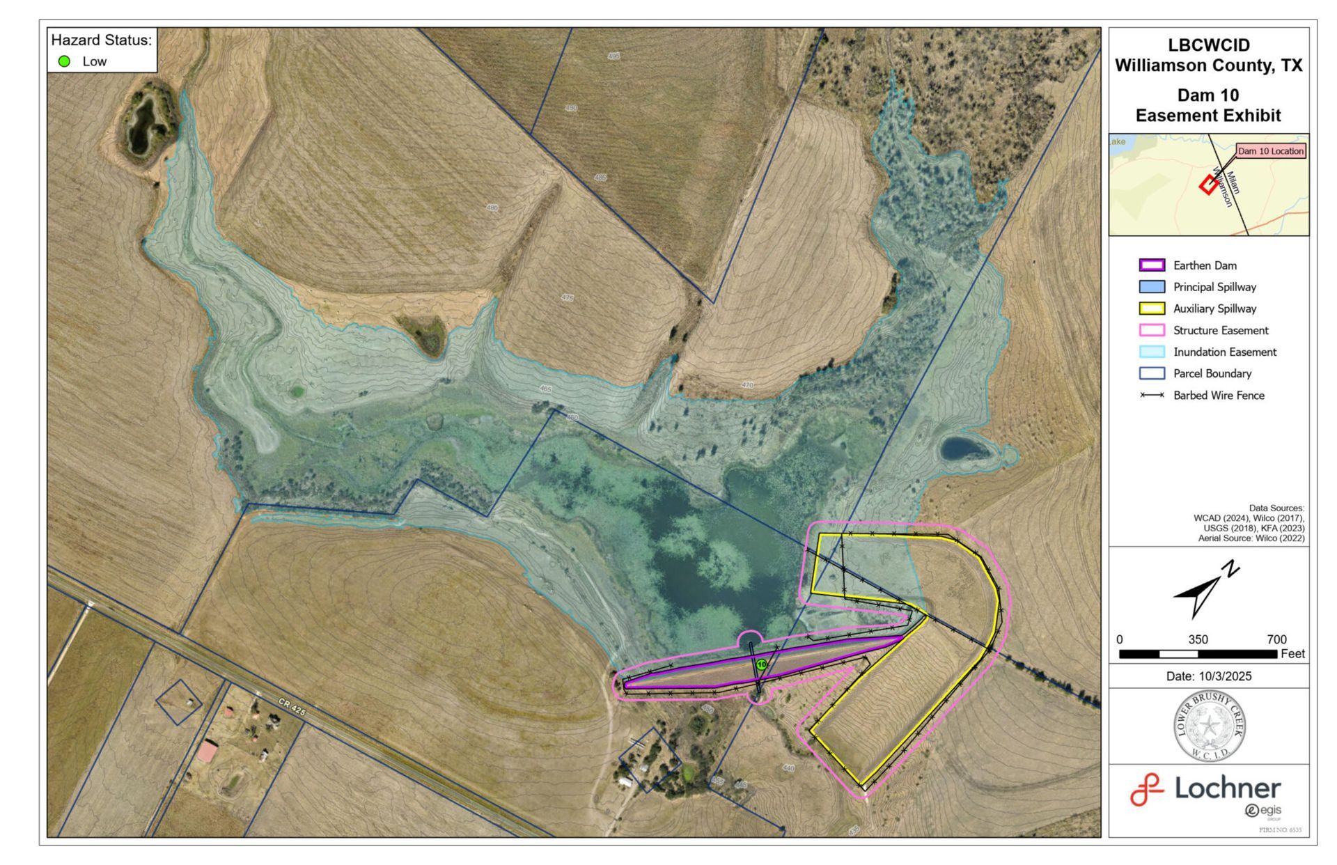
Site #10
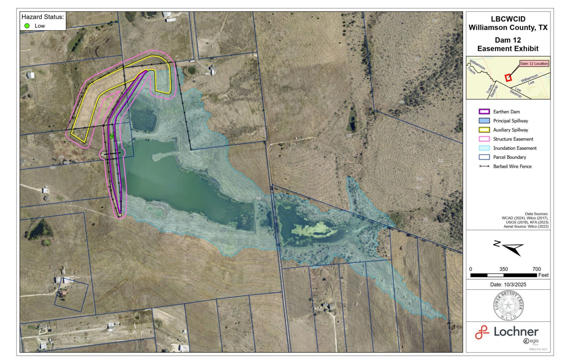
Site #12
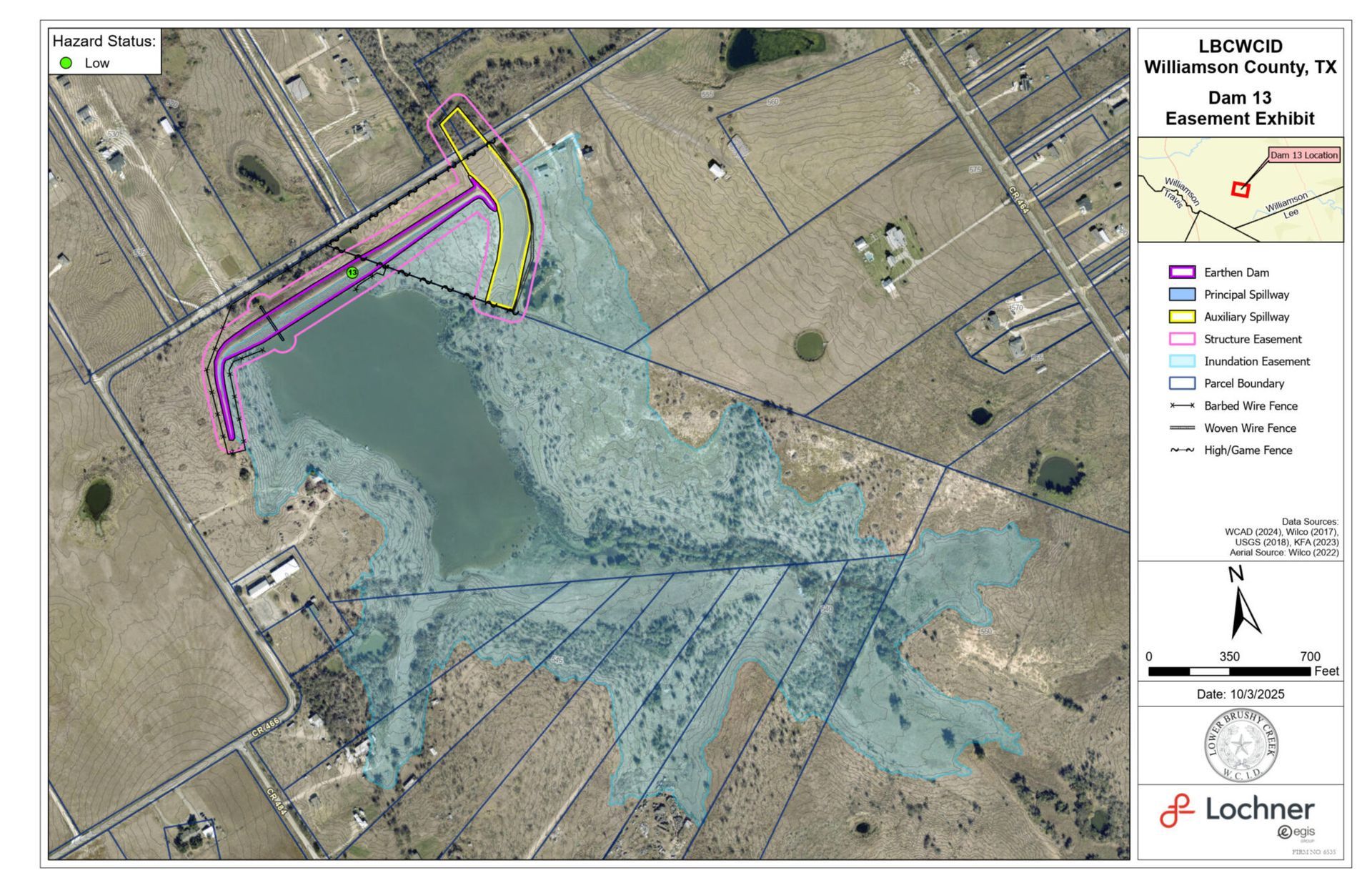
Site #13
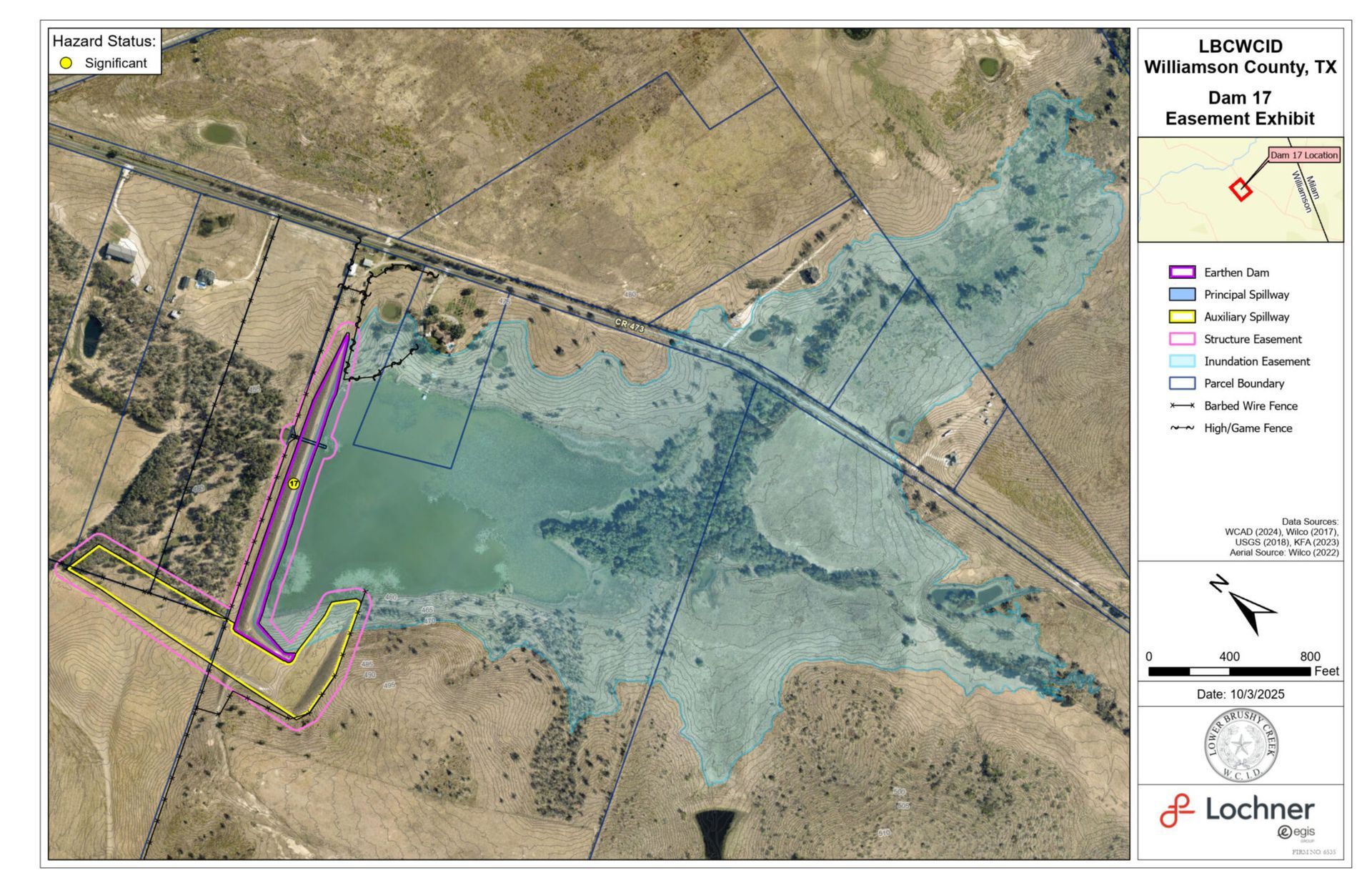
Site #17
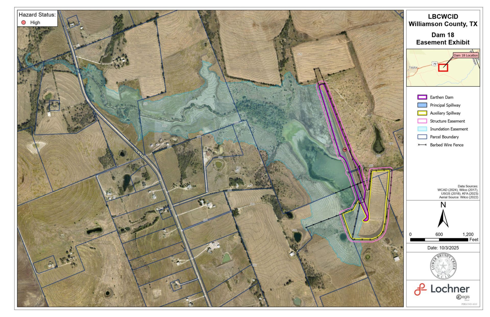
Site #18
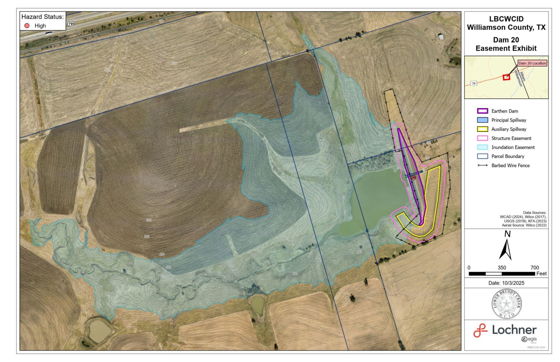
Site #20
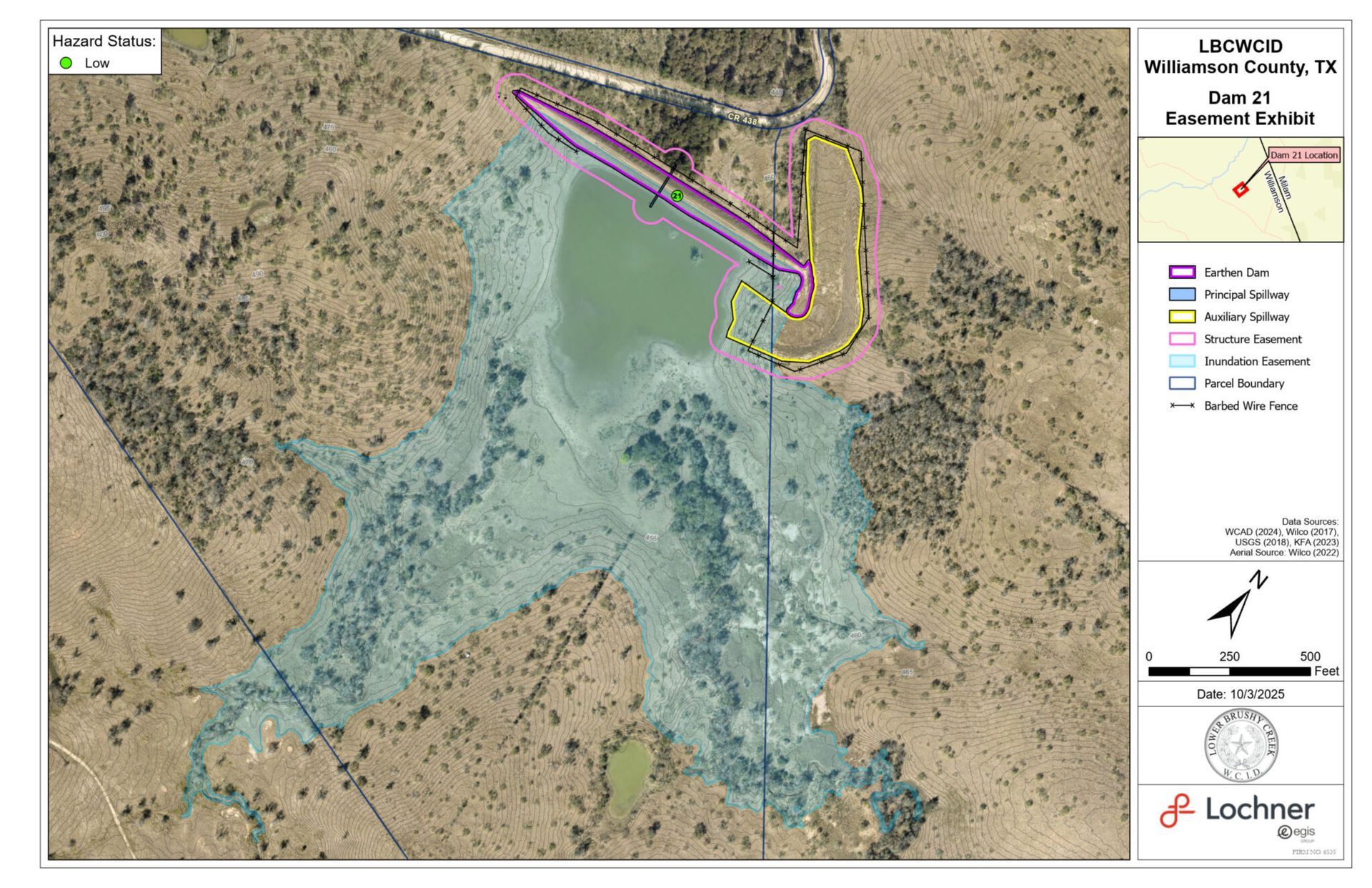
Site #21
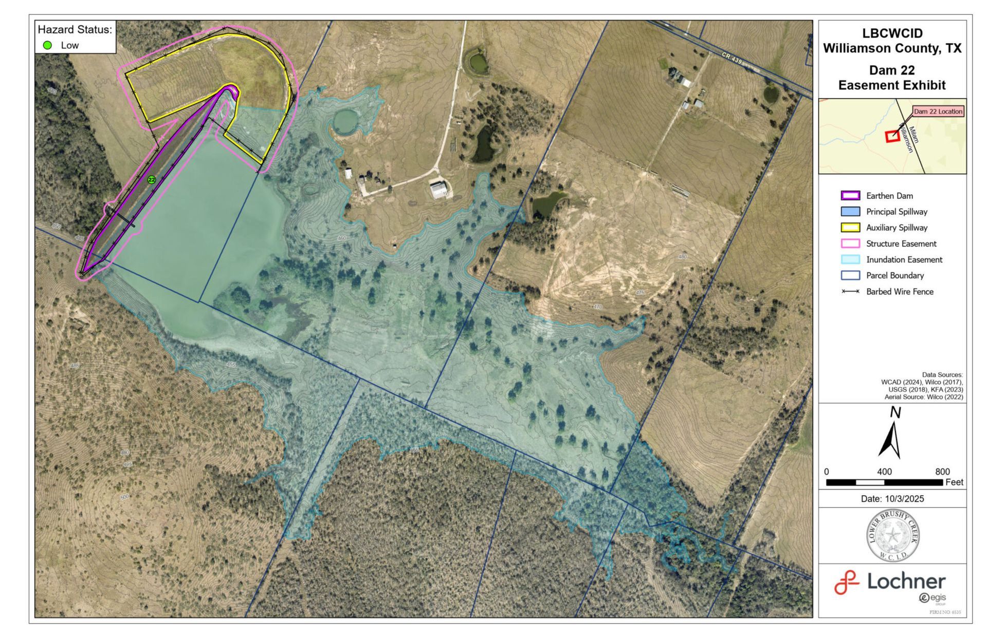
Site #22
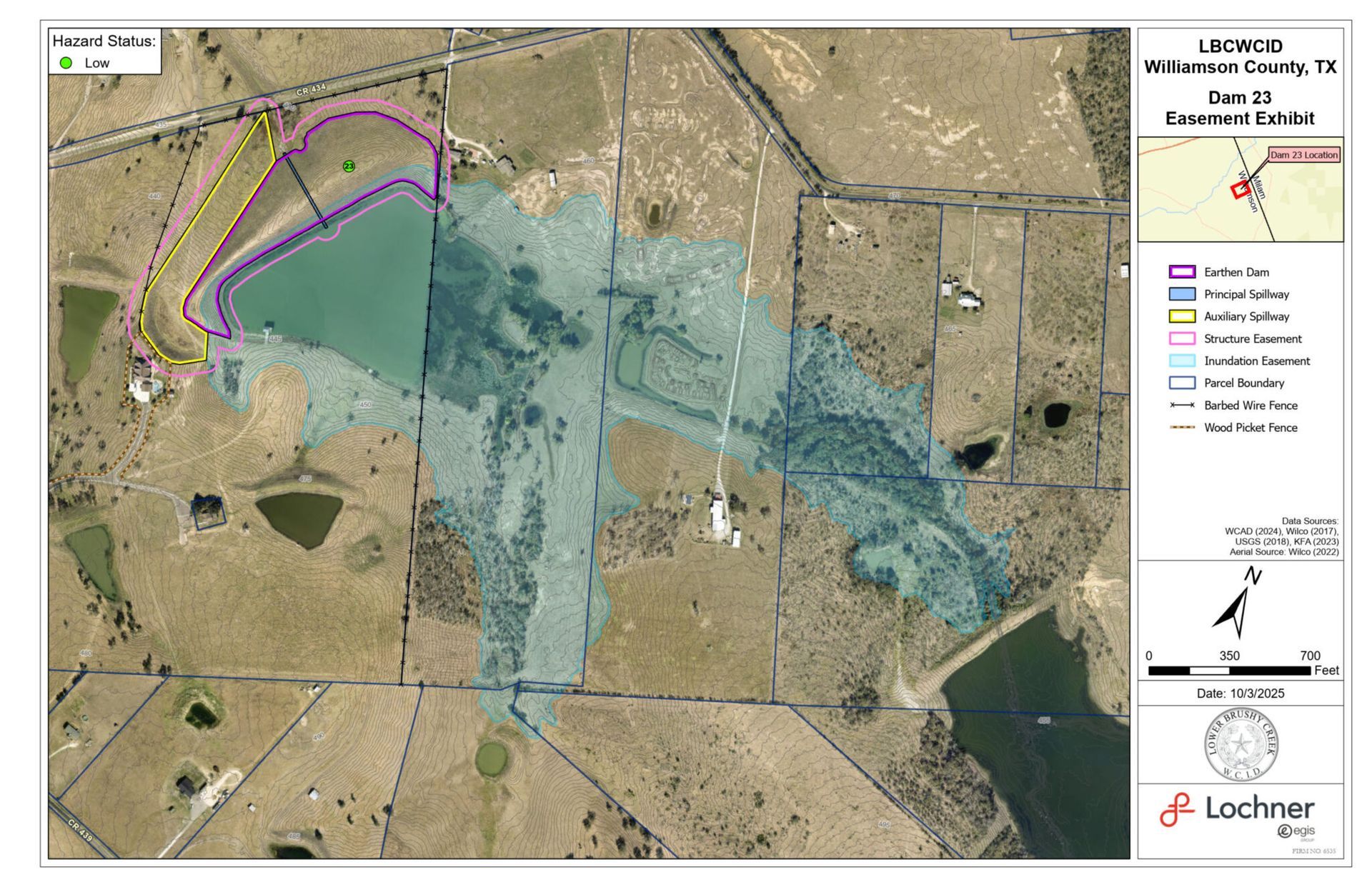
Site #23
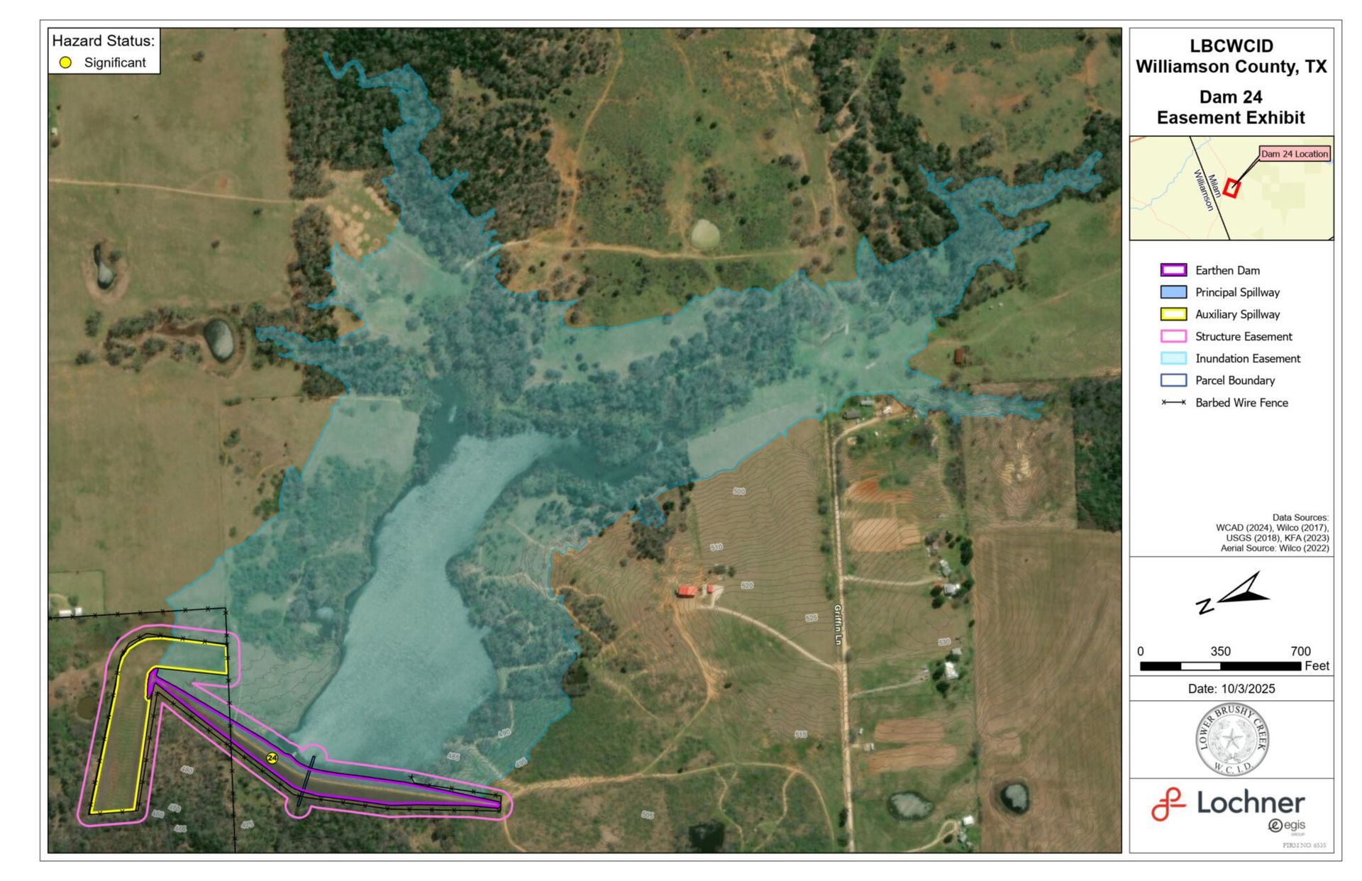
Site #24
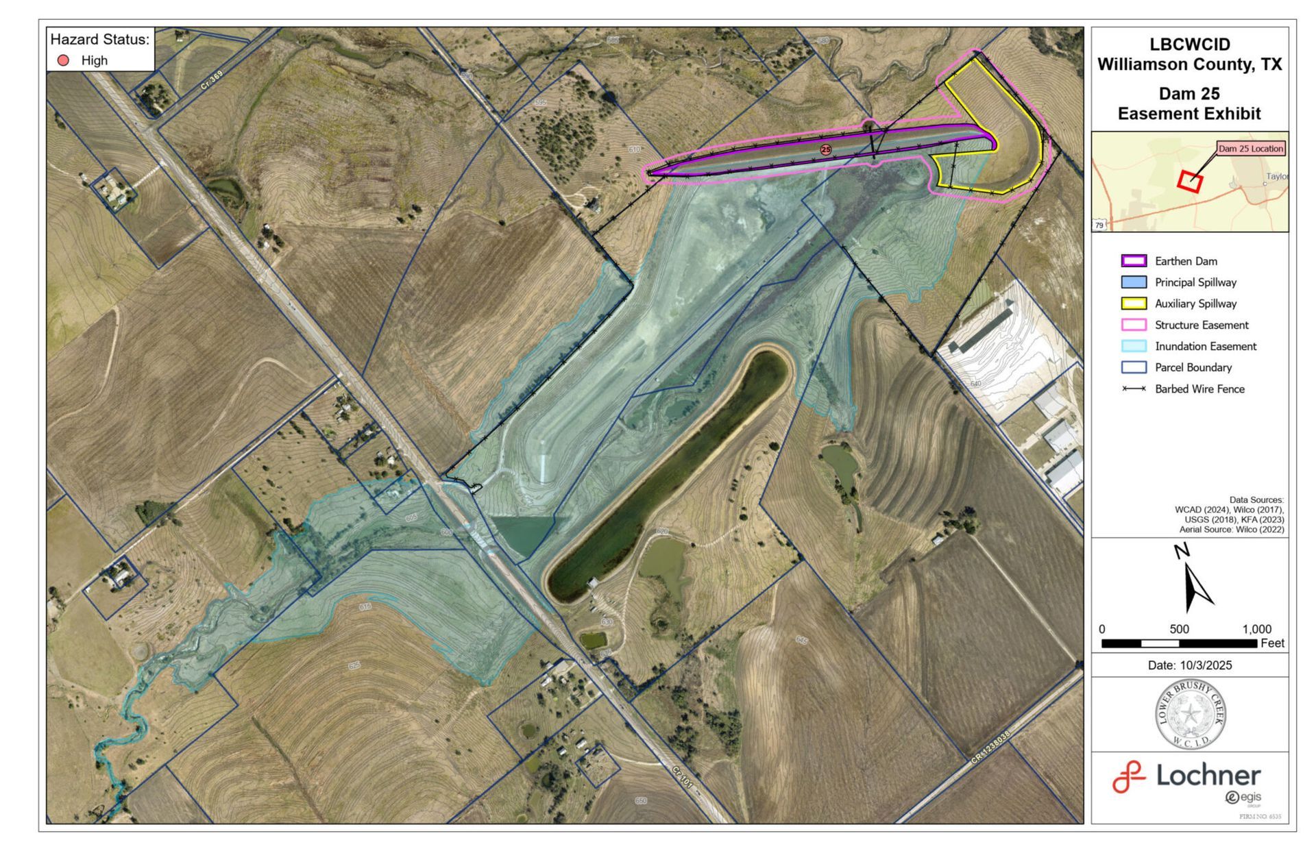
Site #25
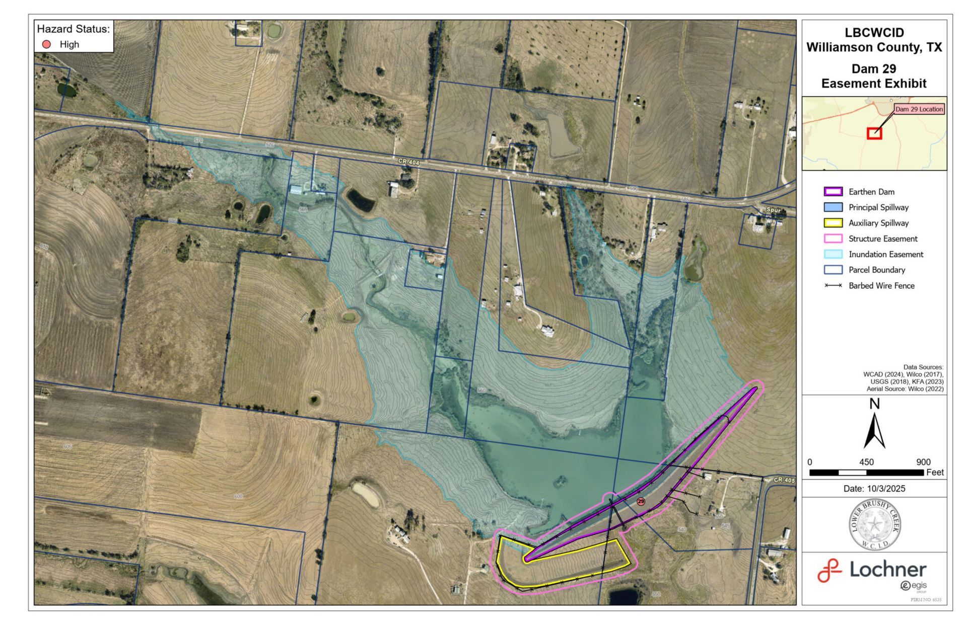
Site #29
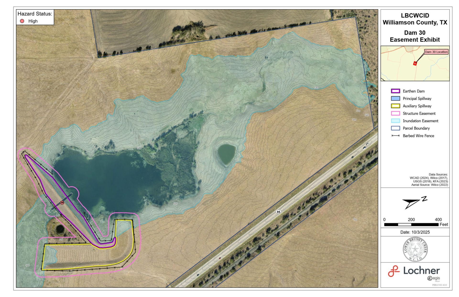
Site #30
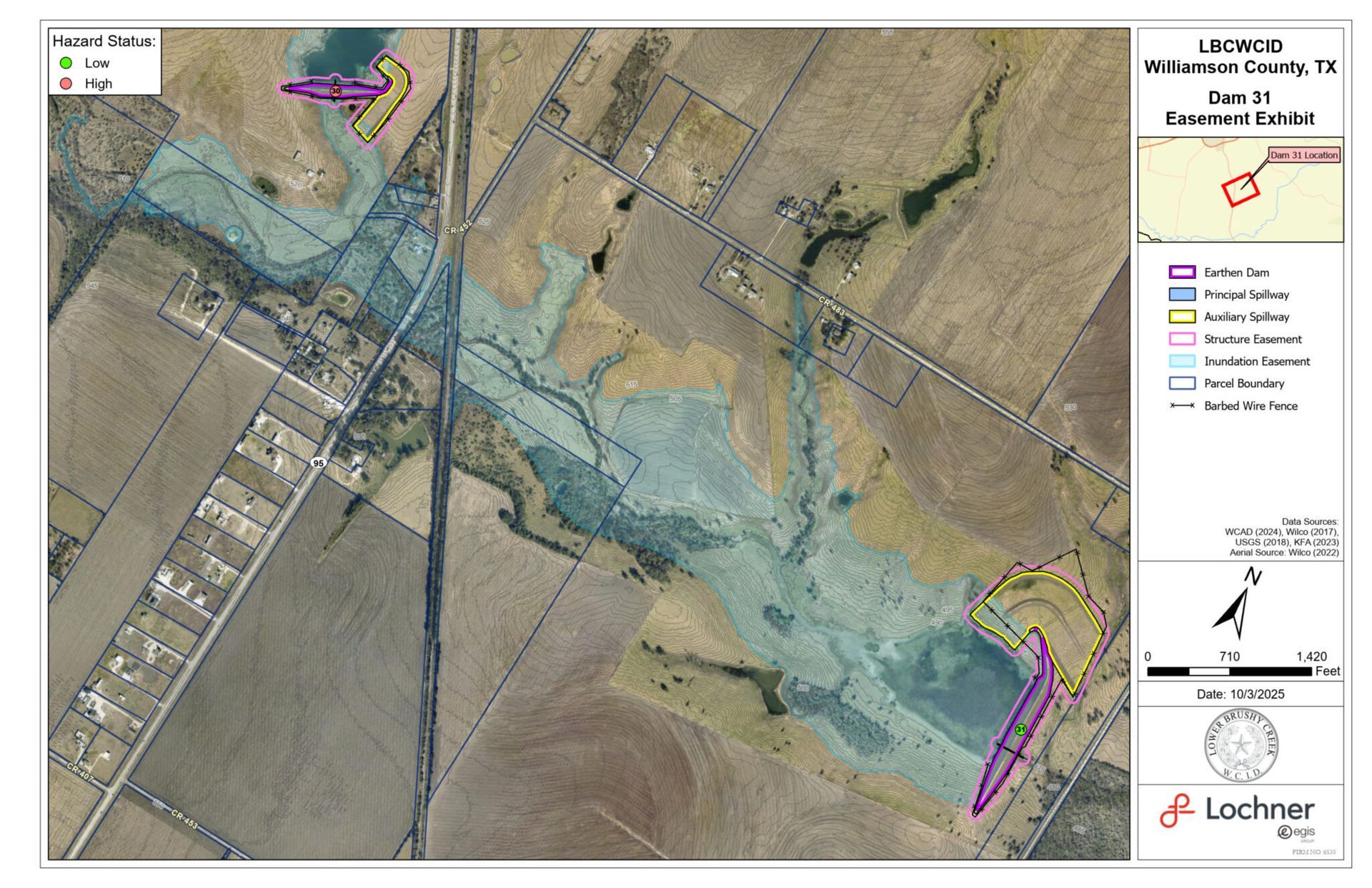
Site #31
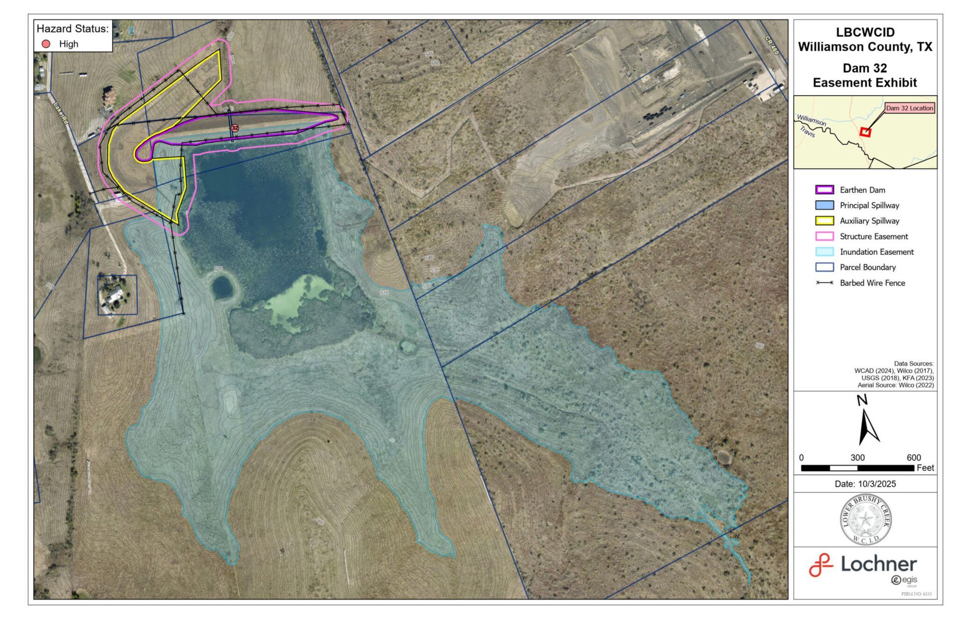
Site #32
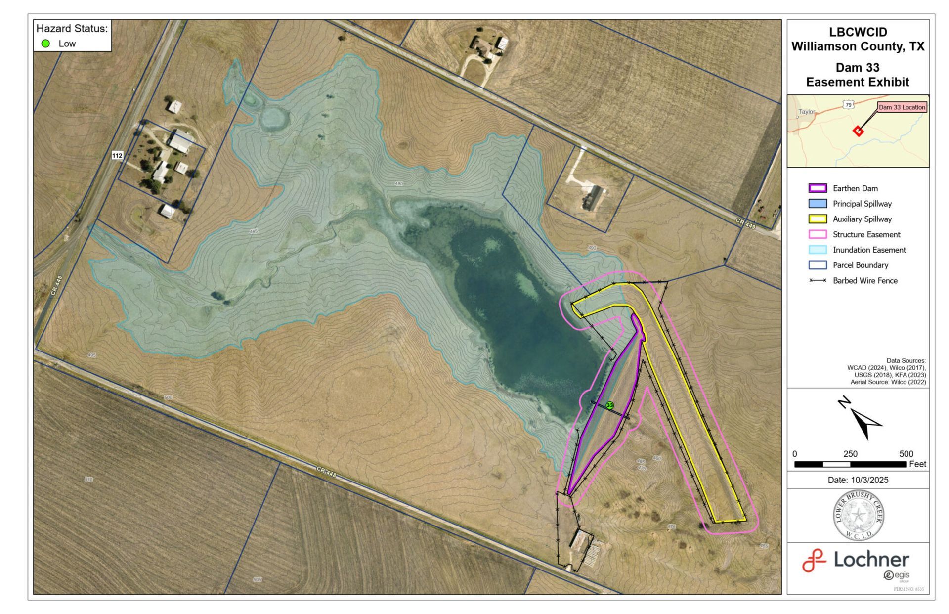
Site #33
Other Mapping Tools
The district provides or links to several supplemental geographic tools useful for residents and emergency planners:
Roads

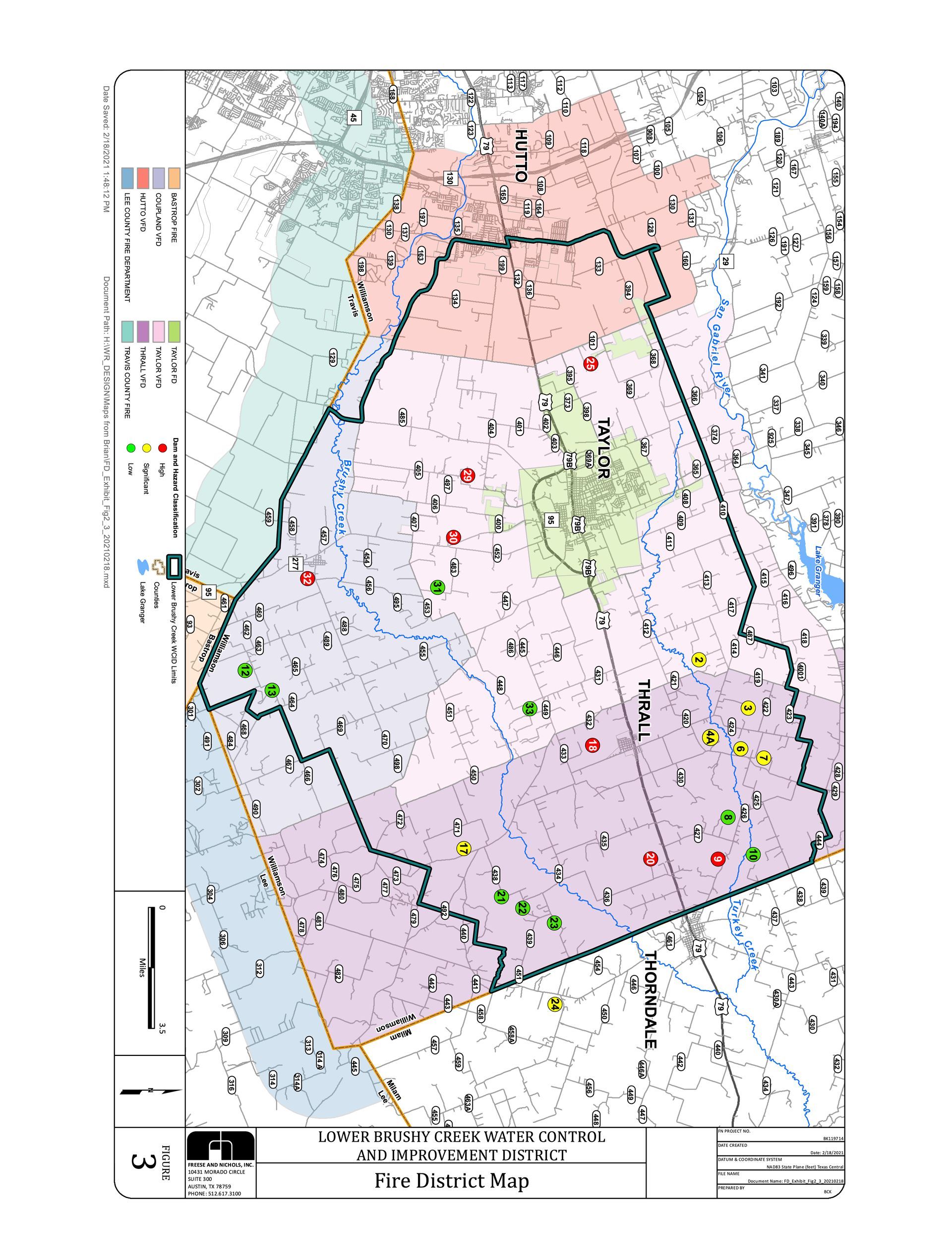
Fire District
Drainage

Questions About a Dam or Map?
Visit our [Contact page] to request additional details or interpretation of dam data. If you’re a developer, engineer, or emergency planner and need GIS files or KMZ access, please reach out through our contact form.